What is Geosteering? From Guesswork to Subsurface Navigation
1minutes reading
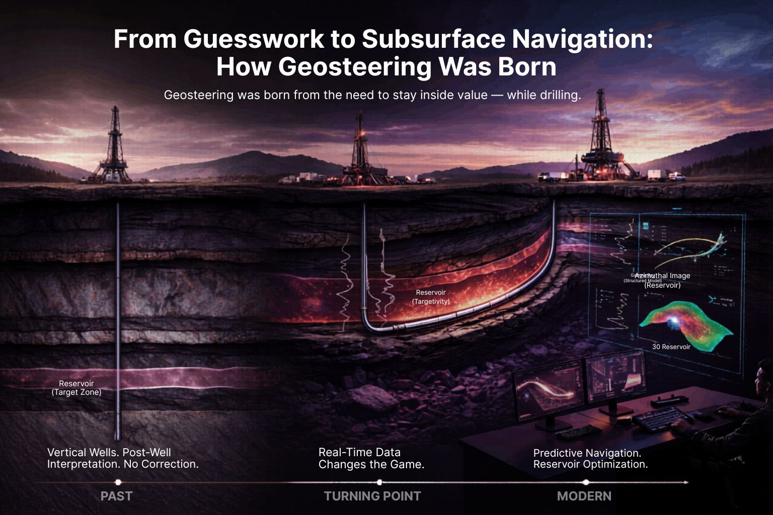
There was a time when wells were drilled vertically, and geology was interpreted after reaching total depth. If the reservoir was thinner, deeper, or structurally shifted, there was no correction. You drilled another well.

Directional drilling changed trajectory control, but it didn’t solve the real challenge: staying inside the reservoir.

The real transformation came with horizontal drilling. Success was no longer about hitting a target point — it was about remaining within a thin productive layer for thousands of feet.A vertical error of just a few feet could significantly impact production.
That shift created the need for real-time subsurface control.

Logging While Drilling (LWD) made that possible. For the first time, geologists could interpret Gamma Ray, Resistivity, Density, and azimuthal data while drilling. Decisions moved from post-well analysis to live operational execution.

Geosteering was born from that necessity.

Over time, it evolved from reactive adjustments to predictive navigation — integrating structural modeling, petrophysics, drilling mechanics, and reservoir objectives.

Today, digital platforms and AI assist interpretation, but the core remains unchanged: geological judgment under operational pressure.

Geosteering has moved from “hitting a target” to optimizing reservoir exposure and protecting well economics.

And in many modern developments, well placement determines more value than any other single drilling decision.

What do you believe was the biggest turning point in this evolution?
Leave a Reply